Owners

See what’s really happening across your portfolio

Document your projects from every angle with drones, 360 cameras and robots to build a complete, shareable record that eliminates guesswork.
Used on 3 million sites in 180 countries

Stop running capital programs on competing versions of reality.

Documentation & disputes

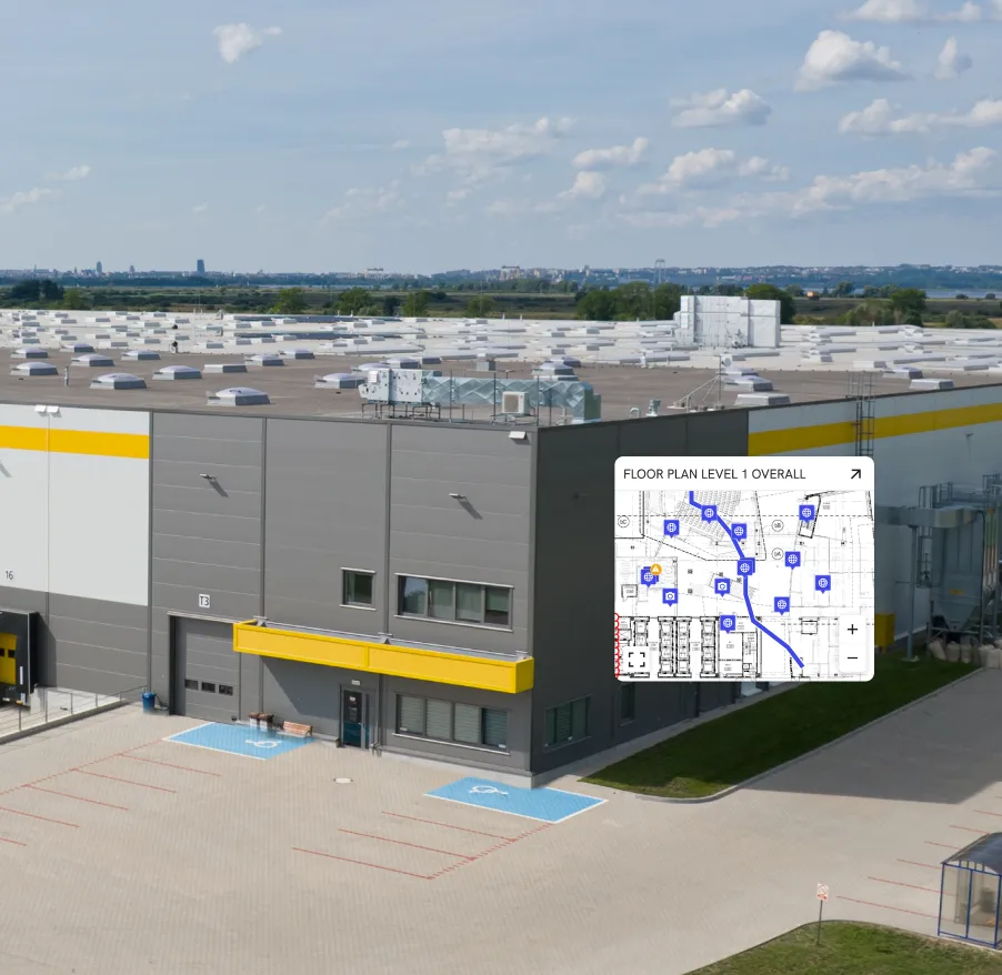
Capture what matters before it’s covered.

Build a timestamped time capsule for WIP verification, change orders, delay claims and lessons learned across projects.
Remote visibility

See every site without leaving your desk.

Give execs, owner’s reps and facilities teams a shared, dated view for OACs, portfolio reviews and audits.
Planning & maintenance

Plan capital programs off reality, not opinions.

Use drone maps and 360 photos for phasing, handover readiness and commissioning and future fit‑outs across your portfolio.

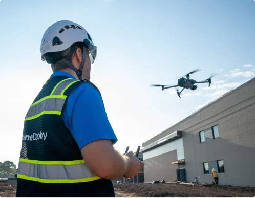
Capture from every vantage point

DroneDeploy Aerial

Portfolio-wide visibility in every flight
Track built vs planned across every project
Overlay design and BIM on live site maps
Validate progress and quantities from the sky
Build your as-built record as you go
Eliminate guesswork for asset maintenance, capital planning and audits

DroneDeploy Ground

Combined with detailed on‑the‑ground coverage
Use robots and 360 cameras to track interior build‑out and equipment installs
Document 360° exterior and campus walks in a single pass
Pin issues and verify work in place without repeat site walks
Capture conditions before handover and tenant turnover
Walk (or drive) once, share with every stakeholder
Create asset maintenance schedules based on current conditions

Need a full feature list and custom quote?

Supported hardware

Build your fleet
(or let us do it for you)

Data on demand

Need the data but don't have pilots or hardware yet? Skip the hardware entirely. Tap into our professional network to capture your sites from any vantage point, at any frequency.
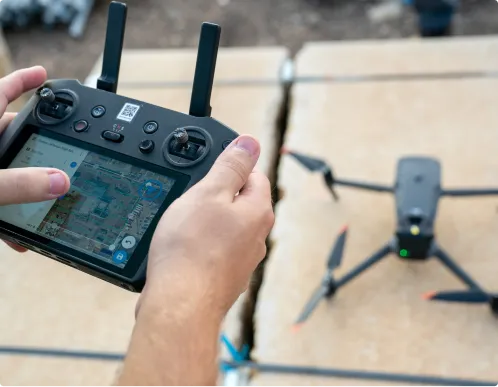
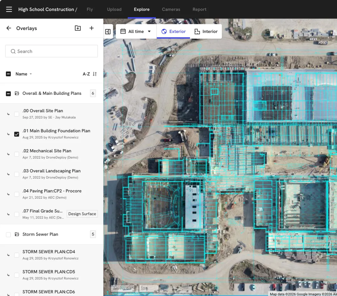
Get your data delivered to you

Drones

Our construction photo documentation software integrates with top drone manufacturers so you can generate survey‑grade maps and 3D models across campuses, plants and data center sites with ease.
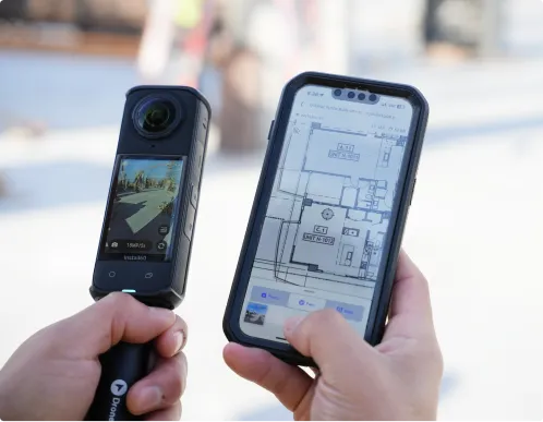
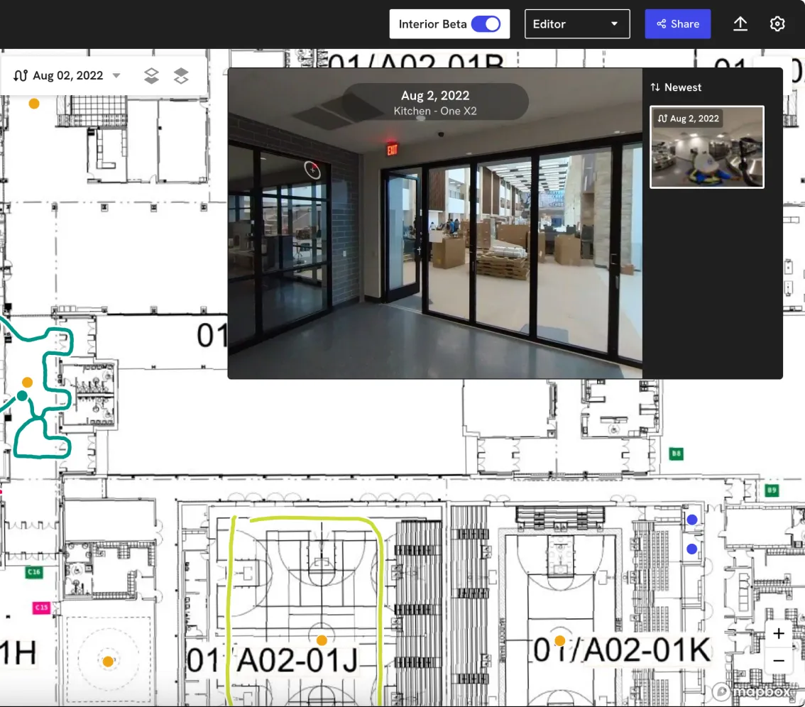
Get the right drone for your use case

360 cameras

Our reality capture software supports ground-based capture with trusted 360‑degree cameras to map interior and exterior walks directly to your floor plans and campus maps.
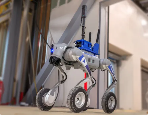
Order a 360 camera kit

Docks and robots

We integrate with leading drone docks and ground robots to keep your visual record updated automatically on mega‑sites and critical facilities.

Get a robot on your site
Integrations

Don't just collect data – connect it.

See all 80+ integrations

Don’t operate off opinions.

Make decisions based on what’s actually happening on every project.
Establish truth
Owner visibility
Boost efficiency
Real-time
elevation data
Build a time capsule
Increase asset value
"DroneDeploy is that objective truth that is very difficult for anyone to argue against."
Matt Craske
Former Head of
Global Program
Controls, Google
See how
"Owners love being able to understand the cleanliness of the site and how we’re carrying out construction."
Alex Ramirez
Director of Construction Technology
See how
"We’re seeing a 30% efficiency gain with DroneDeploy, which we pass onto our clients."
Jay Ferguson
Head of HSE & Innovation ANZ
See how
"We capture real elevations instead of relying on a Xerox copy of a survey from the eighties. The more we swim accuracy upstream, the better."
Blake Berg
Senior Vice President of Development & Construction
See how
"I look at reality capture as a time capsule. For the next 40 years, owners will need this data when they renovate, open a wall, or pinpoint a leak."
John Niles
Senior Program Manager
See how
"A building has more value if it has a documented track record of what's inside the walls. It lowers the overall capital cost to improve the asset."
Raymond Huynh
Project Director
See how
Frequently asked questions

Is DroneDeploy the right fit for your capital programs?

What if our contractors already use DroneDeploy?

That’s a strength, not a conflict. Standardizing on your own DroneDeploy org gives you an independent record owned by the owner – so you’re not relying solely on GC documentation when issues, claims or audits come up.

Is this only for hyperscale data centers and mega‑projects?

No. Owners use DroneDeploy for everything from single hospitals and factories to global portfolios. If schedule risk, change orders or claims matter to your program, the size of the project doesn’t.

Do we need in‑house pilots or a dedicated capture team?

You don’t. Many owners start with Data on Demand and a small internal footprint, then scale into standard capture workflows with GCs, consultants and regional teams as value is proven.

Can DroneDeploy meet our security and compliance requirements?

Yes. Customers use DroneDeploy as a central platform for flight operations and data because it offers encrypted data at rest and in transit, role‑based permissions, and enterprise‑grade controls including SOC 2 and ISO 27001 certifications.

How does this help project controls and finance?

Reality capture becomes the prime source for status and progress – a visual, time‑stamped record you can reference when reconciling pay apps, claims, contingency drawdowns and lessons learned.

Can we trust this data for audits, disputes and lessons learned?

Yes. You get a date‑stamped time capsule you can scroll back through – week by week or phase by phase – to see exactly what was on site, where and when, instead of debating recollections.

How does this fit with our existing tools (Procore, ACC, Esri, BI)?

DroneDeploy acts as the visual layer. Maps, 360 photos and issues can be linked into your CDE, GIS and reporting tools so project teams, executives and auditors are all pointing at the same record.

How does DroneDeploy help with capital planning?

It gives project controls and finance a visual, time‑stamped record of scope and progress across sites, so you can size budgets, prioritize projects, and validate draws and contingency use against what’s actually built.

How does DroneDeploy help with long‑term asset maintenance after handover?

Your “time capsule” of maps and 360 walks becomes the starting point for facilities and O&M – showing what’s in the ground, walls and ceilings – so maintenance, upgrades and investigations rely on reality, not old drawings and walkthrough memories.

Getting started is simple. Request a demo today.

Book a demo